Geopark Program


Environmental Maintenance Activities
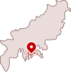
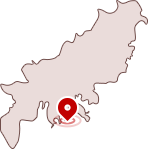
Busan National Geopark geological attraction environmental maintenance activities


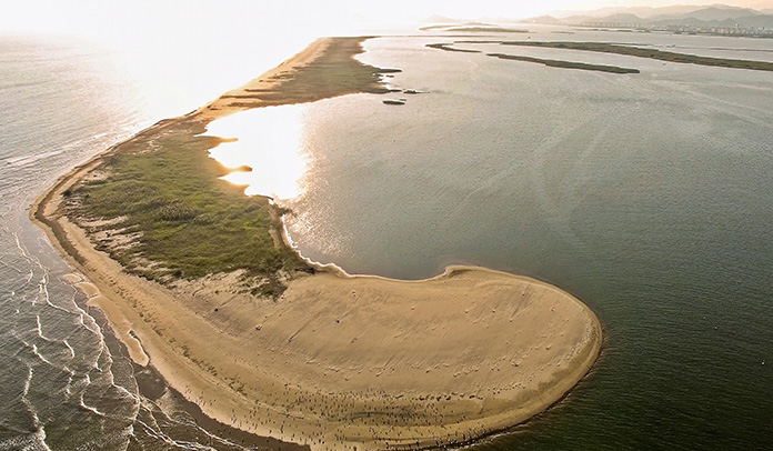
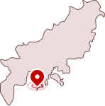
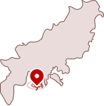
Nakdonggang Estuary
As the modern delta formed by Nakdonggang River meeting the South Sea, the attractions including sand bars, sand dunes and lagoons created by sand piles are the highlight of natural beauty.
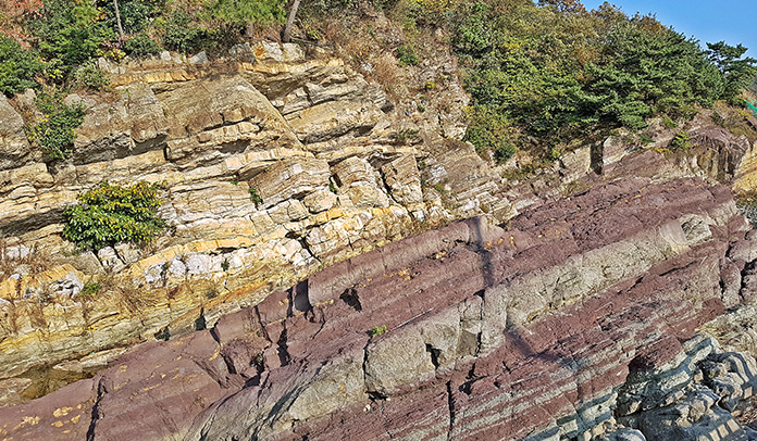
Morundae
The lower Dadaepo Formation formed 80 million years ago. The tectonic change after that time can be seen here at Morundae. This site can be called the textbook of geology, for it includes various geological features like faults, fault rocks, dykes, veins, chert, cross-beddings, and trace fossils.
Dusong Peninsula
Once the paradise of many Late Cretaceous dinosaurs, this site gives an insight to the ancient environment by nest and egg fossils. Also, clastic dykes and seismite clearly shows the past activity of earthquakes.
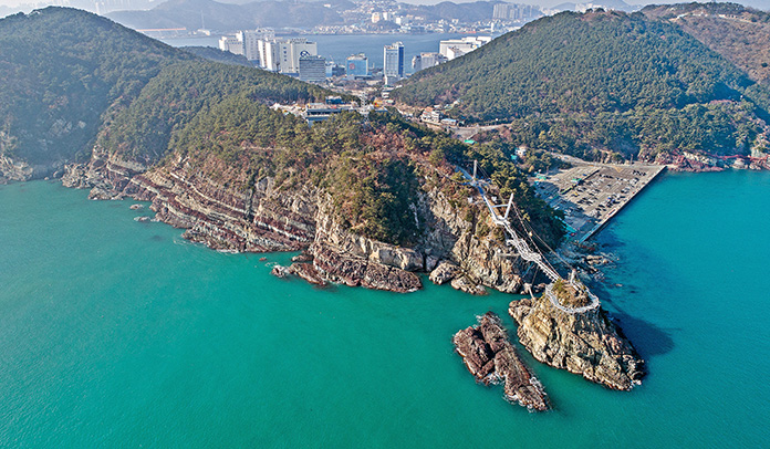
Songdo Peninsula
Along the shore, various rocks, such as sedimentary rocks of Dadaepo Formation, basalt, pyroclastic rocks, and intrusive rhyolite are exposed with dinosaur bones, egg nest fossils, and calcic paleosols. You can enjoy the various geologic records with the marvelous landscape of Hallyeohaesang.
Dudo
Along the shore, various rocks, such as sedimentary rocks of Dadaepo Formation, basalt, pyroclastic rocks, and intrusive rhyolite are exposed with dinosaur bones, egg nest fossils, and calcic paleosols. You can enjoy the various geologic records with the marvelous landscape of Hallyeohaesang.
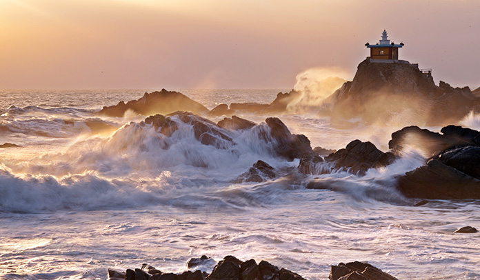
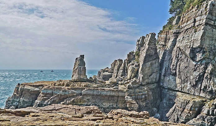
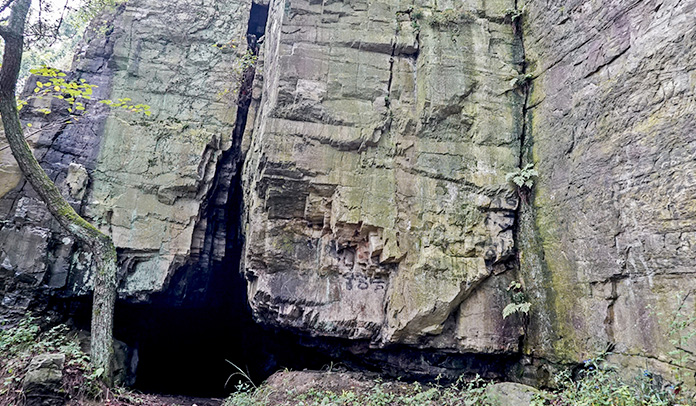
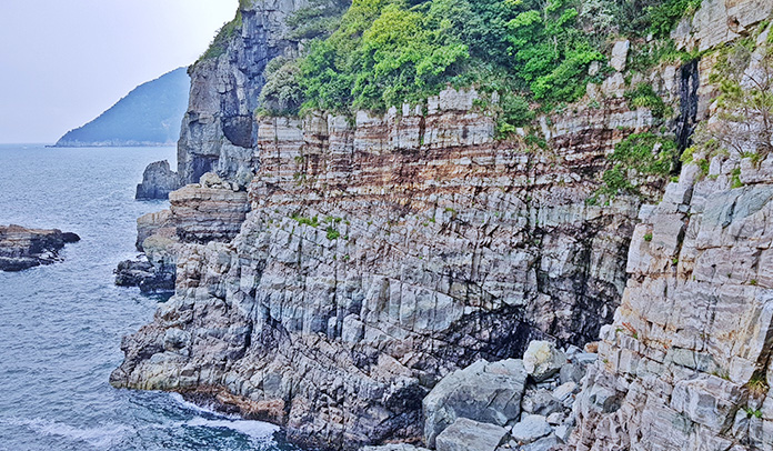
Taejongdae

aejongdae is a landmark of Busan, showing various erosional landforms, such as sea cliffs, wave-cut platforms and sea caves created on the lacustrine sedimentary rocks at Late Cretaceous period. Marvelous geolgical sceneries such as orbicular hornfels, flower structure, slumps formed by earthquake are also found.
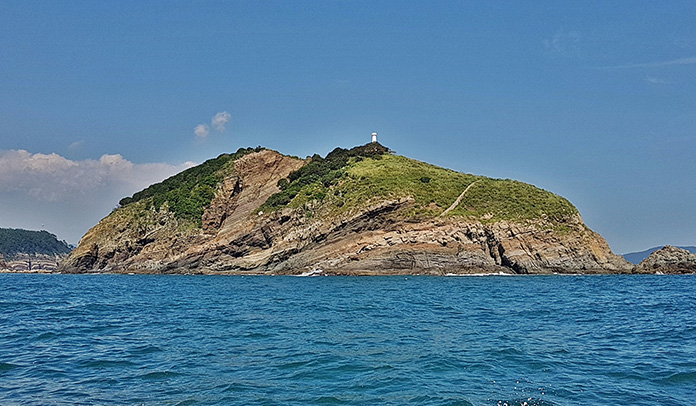
Oryukdo

By a powerful eruption of andesitic volcanoes 80 million years ago, volcanic ash and pyroclastics where topped and eroded by wave action to create grand sea cliffs, wave-cut platforms, and sea caves.
Igidae
By a powerful eruption of andesitic volcanoes 80 million years ago, volcanic ash and pyroclastics where topped and eroded by wave action to create grand sea cliffs, wave-cut platforms, and sea caves.
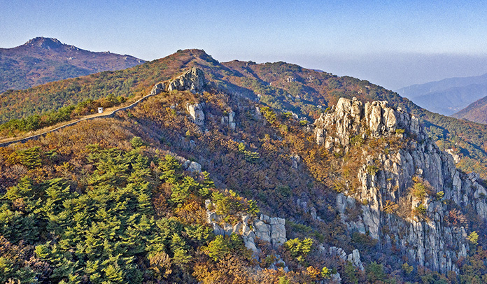
Mt.Jangsan

Born by a rhyolitic volcanic activity that occurred 70 million years ago, a mountain consisting volcanic ash, lava, and pyroclast was made. Spherulitic rhyolite, porphyritic rhyolite, and rhyolitic tuffs can be found with magnificent scenery of Jangsan Fall, talus, and the skyline of Busan.
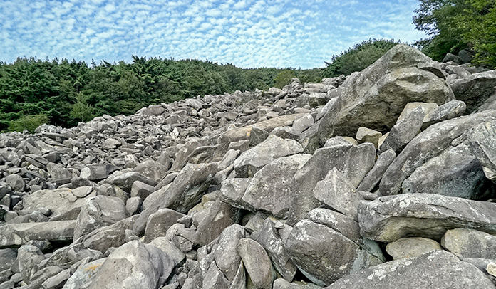
Mt.Geumjeongsan

This mountain is the root of Busan that was cooled underground 70 million years ago, and underwent uplifting to this day. It was carved by wind and rain for who-knows-how-long to create enjoyable cliffs, tor, gnamma, inselberg, and block streams.
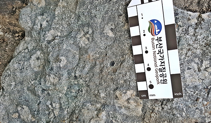
Orbicular Gabbro
Near Hwangryeongsan, gabbros made by magma cooling slowly made minerals to form a concentric circle, showing a well-made orbicular texture. This is the only site of orbicular gabbros in Asia, and is very rare throughout the world, making it a site of high value.
Mt.Baekyangsan
Various pyroclastic rocks created by the volcanic activities 80 million years ago, sedimentary rocks deposited at lakes, intrusive granites, and limestone caves formed by the dissolution of calcareous paleosol layer shows the geologic history that Busan underwent.
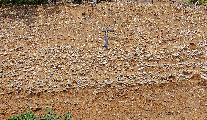
Nulchado
Nulchado is a small island located to the northeast of Gadeokdo, the largest island in Busan. The island has many high mountains with mostly steep slopes, and has a complex coastline with small inlets and bays. The Nulchado area comprises the Cretaceous Yucheon Group and the Bulguksa Granite.
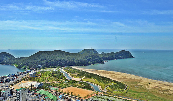
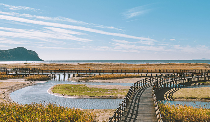
Dadaepo
Dadaepo Beach is a wide sandy beach in the eastern part of the delta that developed at the Nakdonggang Estuary.
Amnam Park
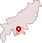
Amnam Park is located to the south of the Songdo Peninsula, which corresponds to the southeastern part of the Dadaepo Basin.
Jodo

Jodo, an island connected to the mainland by a bridge, has a trail along the coastal cliffs around the island.
Haeundae
The Haeundae geosite, the one of symbols of Busan and one of Korea's the most popular summer holiday destinations, consists of a beach with a length of 1.5km, a width of 70–90m and an area of 120,000m2 , a land-tied island Dongbaekseom on the west, and a natural hot springs located behind the white sandy beach.

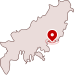
Songjeong

The Songjeong Pseudotachylyte geosite is located on a secluded beach in the eastern part of Busan Metropolitan City, and various igneous rocks, such as andesite, andesite tuff, dacite, and rhyolite that compose the Jangsan igneous body, part of the igneous rocks in Yucheon Group formed during the Late Cretaceous.
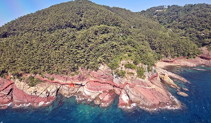
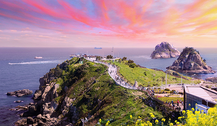
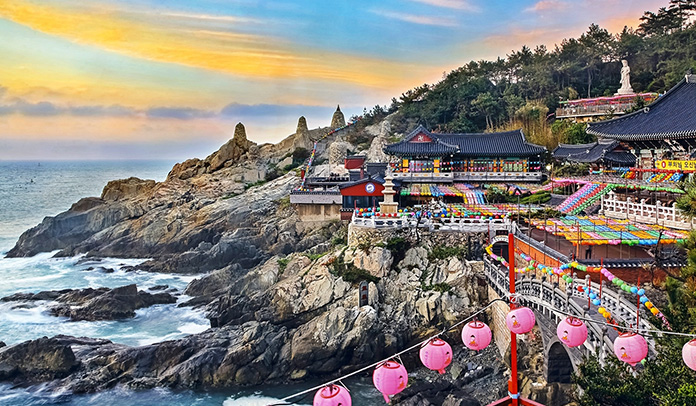
Yonggungsa

The Yonggungsa geosite is located around the Haedong Yonggungsa, a temple and tourist attraction point in the eastern part of Busan Metropolitan City.
Orangdae

The Orangdae geosite is located on the east coast of Busan and is well known as a sunrise spot. In the geosite, igneous rocks, mainly lapilli tuff, are distributed, and enclaves such as xenolith and MME(Mafic Microgranular Enclave) and joint groups developed in various directions are observed.